
Smackover Discovery (AL)
OCS Discovery (SLA)
OCS Discovery (SLA)
PRESENTED HERE.
At the onset of the COVID-19 shelter-in-place quarantine, when we were all sheltering in place, oil prices were crashing, and LinkedIn was filled with the poignant posts of people who'd been laid off or forced into retirement, Steve Walkinshaw started his popular LinkedIn Oil Patch Quizzes. These quizzes were intended to distract everyone from the bad news that seemed everywhere in those challenging days. If these quizzes did distract you from all of the bad news out there - if only for a moment - then Steve will have succeeded in his efforts. These quizzes are reproduced here, for those of you who might not have seen their original postings on LinkedIn.
The subject for most of these quizzes is the "oil patch" - the upstream oil & gas community. That having been said, many quizzes also address other topics of geological interest. We hope you enjoy these quizzes. To view the answer for each quiz question, please click here.
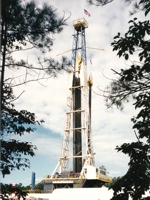
1. When it comes to bottom-hole temperature (BHT), with regard to wells drilled onshore in the state of Louisiana, the hottest recorded BHT (as shown on the log header; final log run) is 487 degrees Fahrenheit. Which specific well I am referring to?
2. There is a large gas field located in Louisiana that produced principally from reservoirs described as "four tuff beds. The greatest thickness of any bed is 29 feet... In the early development of the field the initial open flows were as high as 65 million cubic feet and closed pressures were 1,125 pounds." (AAPG Bulletin, excerpts from the seminal technical paper written about the field.) This gas field produced over 350 BCF in less than eight years from the "four tuff beds", eventually producing half a TCF of gas. What is the name of this prolific field?
3. I'm thinking of a producing carbonate trend in the Gulf Coast that is characterized by several unique properties. One is the unusual composition of the (self-sourced) crude, which typically contains approximately 3 lbs. salt per barrel, 3% to 3.5% sulfur, and is both paraffinic and naphthenic. In this particular trend, dolomitized portions of the reservoir are typically impermeable (or poorly permeable), while the reservoir-quality rock (which can have excellent porosity and permeability) is typically a leached but otherwise unaltered limestone. Although there has been much speculation as to the origin of the producing traps, their provenance remains unclear. What producing Gulf Coast carbonate trend could I be referring to?
4. Nine gas wells in the state of Mississippi have produced in excess of 100 billion cubic feet of gas (each). Two wells have produced in excess of 200 BCF. In the recent past, the state’s long-standing cumulative gas record holder, the Shell #1 Burch (Thomasville Field; 205 BCF), was overtaken by another big gas well, which is now the single most prolific gas well in the state. The new record holder continues to produce ~40 MMCFGPD and has produced 261 BCF to date. Its maximum monthly rate of production was 3,469,406 MCF (average daily rate of 115,647 MCFGPD). So here’s the quiz: simply guess the Btu content of the gas produced by the new record holder. You’ll have a wide range (200 Btu) within which to correctly guess the Btu content and solve the quiz. For example, you could guess 1,000 to 1,200 Btu; 1,200 to 1,400 Btu; etc.
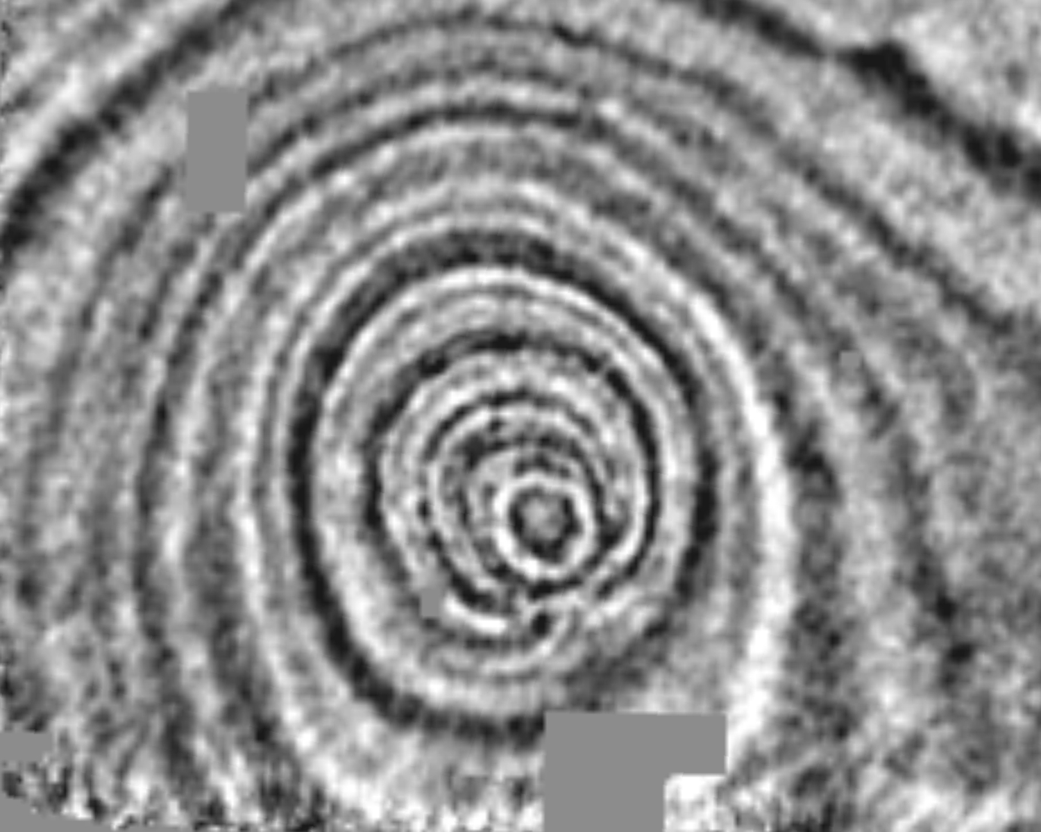
5. One of the most catastrophic events of the Paleogene in the Gulf Coast occurred during the Middle Oligocene in southeast Texas and southwest Louisiana. Many miles of the continental shelf suddenly collapsed, broke apart, and slid basinward, unleashing a megatsunami that raced southward, scouring the flanks of several paleotopographically high areas overlying salt diapirs that were directly in its path. The force of the collapse caused deep powerful currents to erode downward into the underlying Eocene in some areas between the diapirs, depositing thick turbidites. Individual blocks of shelf sediments – some as large as 40 acres or more in size – tumbled chaotically downslope, with some blocks coming to rest literally upside down. The energy released by this catastrophic event was enormous; the explanation for why and where it occurred remains unclear. Just north of the site of the collapse, 3D seismic data has illuminated a very intriguing structural feature. See the time slice. The feature is a very deep, almost perfectly circular and symmetrical depression. What is the common industry name given to the sediments caught up in this catastrophic event? And what are your thoughts about the origin of the circular depression?
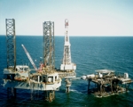
6. The discovery well for the first commercial oil field in a certain Gulf Coast state encountered oil in a fractured carbonate reservoir. The oil column height turned out to be over 300 feet. What was unusual about this discovery was that it has subsequently been determined that the discovery well had coincidentally been drilled at (or very close to) the intersection of a normal fault and a right-lateral strike-slip fault (one of two known to have transected the field area). The oil was trapped in a drag-shear breccia / fracture swarm along one side of the normal fault, which was further enhanced by the transection of the right-lateral strike-slip fault. What was the name of the oilfield that I am referring to, and which state?
7. Long before the recent attempts to make the Eastern Louisiana Austin Chalk Play viable, an operator drilled a very innovative test of the Austin Chalk in the Southwest Mississippi / Eastern Louisiana area. The placement of this test well was based upon the operator’s conceptual application of a successful Chalk exploration paradigm initially utilized in the Viking Graben area of the North Sea. What well am I referring to, and when was it drilled?
8. The seif dune facies of the Upper Jurassic (Middle Oxfordian) Norphlet Formation was first recognized onshore in southeast Mississippi and southwest Alabama. Two counties - one in each respective state - were focal points for the early study of the Norphlet seif dunes, and within the Alabama county of interest, seismic and subsurface control revealed the existence of an impressive Norphlet dune field consisting of multiple seif dunes with parallel axes oriented in a certain (present-day) compass direction. The linear extent of the longest Norphlet seif dunes in this particular Alabama county is as much as 40-50 miles and the most prominent dunes exceed 1,400' in thickness along their axes. The impact of the deposition of these Norphlet seif dunes upon the underlying Louann Salt (compaction) and the overlying Smackover (drape) has now been well documented. So here's the quiz (three questions): What is the name of this key Alabama county, and within this county, what is the (present-day) directional orientation of the axes of the Norphlet seif dunes? Can you name at least one Jurassic oil field discovered within this key county, the entrapment of which was directly attributable to the presence of a Norphlet seif dune?
9. Approximately 29% of the world's supply (and all of the U.S. supply) of an important element is commercially extracted from the produced brine of Smackover reservoirs in two southwest Arkansas counties. What is this element?
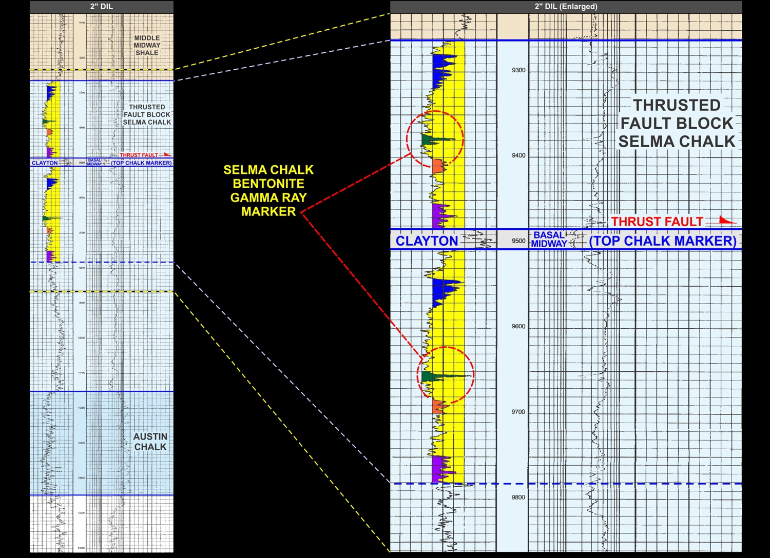
10. In the state of Mississippi, excluding overturned beds encountered in one or two wells drilled on the steep flanks of salt diapirs, only one Mesozoic test well has encountered a true repeated stratigraphic section; a portion of the log from that well is illustrated below (the right log panel is simply a zoomed-in version of the left log panel). In this well, virtually all of the Selma Chalk interval is repeated. Highly correlative gamma ray markers attributable to regionally-deposited bentonites confirm the repeated section. These bentonites, thin layers of weathered volcanic ash (clay), can be correlated over a large geographic area and are attributable to ashfall from volcanic eruptions that occurred in the western United States during Selma time. This well is not located near any salt diapir, or any other substantive salt structure or igneous intrusion. What is the name of this unique well, and where is it located? County name will suffice for your location answer.
11. Phenomenal porosity (often exceeding 30%) and permeability has been encountered in a particular Paleozoic formation in the Black Warrior Basin (BWB) of Alabama and Mississippi. In many areas of the Basin, the lithology of this excellent reservoir rock has been described as a diagenetically-altered spongolite composed principally of leached sponge spicules. This reflects a remarkable time when vast reefal sponge communities flourished in shallow waters during a period of warm climate. It appears such widespread spongolite deposits are comprised of a trend of shallow-water sponge bioherms surrounded by large areas of reworked and redeposited spicule fragments (and other unrelated fossiliferous debris). This siliceous reservoir has also been commonly described as a tripolite that can reach thicknesses in excess of 200 feet. It has been underexplored in most of the Black Warrior Basin, despite its proximity to two important source rocks and the fact that it is very analogous to a prolific time-stratigraphic equivalent reservoir that produces in west Texas and elsewhere. What is the name of this leached spongolitic / tripolitic Paleozoic BWB reservoir (two word phrase)?
[More to follow...]